Beyond the Tetons: Hidden Gems Across Wyoming
Welcome to a roaming Wyoming adventure off the map. Explore outside of Jackson Hole. These wide-open wonders will knock your socks off the beaten path. Below are “best kept” secrets of the cowboy country.
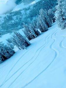
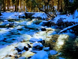
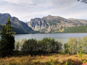
Ski Beartooth Pass
Perched at a breathtaking 10,947 feet above sea level is the crown jewel known as The Beartooth Highway. This stretch of pavement is 68 miles of U.S. Route 212 that winds through the rugged borderlands of Montana and Wyoming.
- Often hailed as “the most beautiful drive in America,” the alpine route offers a dramatic ascent from Red Lodge, Montana.
- It climbs through steep switchbacks and glacial valleys while cresting at the pass in Wyoming.
- From the summit, travelers are treated to panoramic views of jagged peaks, shimmering alpine lakes, and vast plateaus that seem to touch the sky.
*The pass is typically open from late May to mid-October, depending on snow conditions. Eventually in summer, sudden storms can sweep through, adding to its wild allure. Whether you’re chasing solitude, scenic photography, or a gateway to Yellowstone’s northeast entrance, Beartooth Pass delivers an unforgettable high-country experience.
🏔️ How to Ski (or Snowboard) Beartooth Pass:
- Season: Open late May to early July, depending on snow and road conditions.
- Access: Drive the Beartooth Highway from Red Lodge, MT or Yellowstone’s northeast entrance. Check road status before you go; closures are common due to weather.
- Lift Tickets: Buy in person with cash or check only. Full-day tickets are $50; half-day tickets (12–3 p.m.) are $40. Online sales are available but non-refundable.
- Terrain: Expect steep pitches (some up to 50 degrees), cornices, and no-frills skiing. There’s no lodge, no cell service, and no beginner terrain.
- Gear & Prep: Bring everything you need—food, water, layers, and avalanche gear if venturing off-piste. Conditions change fast at 10,000+ feet.
- Follow on instagram @beartoothbasin
*ProTip: Hike and ski/board when the resort is closed for a unique backcountry experience; it’s so fun and I used to do this every year when the road opened at memorial day.
Where to stay? Camp in Red Lodge, MT or stay in Cooke City & visit the historic Miner’s Saloon.
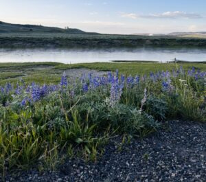
Camp in Sunlight Basin
Tucked away in the remote northwest corner of Wyoming near Cody is a breathtaking expanse of wild country. Verdant meadows, rugged canyons, and snow-capped peaks converge in a dramatic alpine tableau. Named after a moment when sunlight pierced through dense fog to flood the valley, this hidden gem offers a sense of solitude and grandeur that feels untouched by time.
- The basin is rich in history: once traversed by the Bannock Trail and later by Chief Joseph’s Nez Perce during their 1877 flight to Canada
- Today it’s a haven for wildlife; including elk, moose, bighorn sheep, and even grizzly bears.
- Visitors can explore the area via the scenic Chief Joseph Highway, hike along Sunlight Creek, or simply soak in the serenity of one of Wyoming’s most enchanting landscapes. Click Here for more details.
Accordingly, access the basin via the Chief Joseph Scenic Highway known as Wyoming Highway 296. This route offers one of the most breathtaking drives in the state, winding through the remote and rugged beauty of Sunlight Basin and Sunlight Canyon. As you ascend Dead Indian Pass, the views open up to dramatic cliffs and deep gorges, including the awe-inspiring Sunlight Gorge, where Sunlight Creek carves through thousand-foot canyon walls.
- The drive is a sensory feast: alpine meadows, towering peaks of the Absaroka and Beartooth ranges, and the winding Clarks Fork of the Yellowstone River all unfold in cinematic fashion.
- Wildlife sightings are common—elk, moose, and even grizzlies roam the area
- Interpretive signs along the way reveal the rich cultural and geological history of the region.
Simultaneously chase solitude, scenic photography, or a deeper connection to the land’s storied past. The Chief Joseph Highway through Sunlight Basin and Canyon is a journey that lingers long after the last switchback.
Protip: Experience the frontier spirit and horseback ride the trails up the Southfork of the Shoshone River outside of Cody.
Hike the Shell Canyon Bench Trail
Also known as Shell Bench Trail #184, this path is a striking 10.6-mile point-to-point hike in the Bighorn Mountains near Greybull, Wyoming. This intermediate-to-difficult trail offers a dramatic transition from lush alpine forest to arid desert canyon, showcasing the diverse terrain that makes Shell Canyon such a hidden treasure.
- With an elevation range from 7,805 feet down to 5,114 feet, hikers experience a steady descent through rugged switchbacks, loose rock, and sweeping vistas that rival the most famous canyons.
- The trail is lightly trafficked and best enjoyed from late spring to early summer, making it ideal for those seeking solitude and raw natural beauty.
- For a seamless experience, many hikers recommend a shuttle setup—starting at the Adelaide Trailhead and ending at the Post Creek Parking Area off Highway 14.
Protip: Mountain Bike this trail.
Yes, you can bike the Shell Canyon Bench Trail (this is what I did on my mountain bike)! It’s actually considered one of the better mountain biking routes in the Bighorn Mountains. The trail (same as above hiking trail) is a 10.6-mile singletrack that transitions from alpine forest to steep desert canyon, offering a thrilling mix of terrain and scenery. Riders often tackle it as a point-to-point route, starting at the Adelaide Trailhead and finishing at the Post Creek Parking Area off Highway 14.
The ride includes:
- 🌲 Forested climbs and open meadows
- 🏞️ Fast, technical descents with loose rock
- 🐾 Wildlife sightings and expansive views
- 🚗 Recommended shuttle setup for convenience
It’s rated intermediate to difficult, so it’s best suited for experienced riders looking for a remote and rewarding adventure.
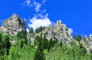
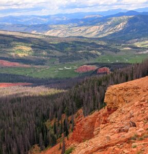
Explore Tensleep Canyon
Carved into the western slopes of the Bighorn Mountains near the tiny town of Ten Sleep, Wyoming, is a geological and recreational marvel. It is Traversed by U.S. Highway 16, affectionately known as “The Sweet 16”. This canyon offers a dramatic descent from alpine meadows near Meadowlark Lake into red-ridged foothills and towering limestone cliffs etched by millennia of wind and water. It’s a haven for rock climbers, with over 1,400 bolted routes on world-class limestone, making it one of the premier climbing destinations in North America.
Beyond climbing, the canyon invites further exploration through:
- Endless hiking
- Extreme mountain biking
- Explore caving
- Dispersed camping available along its rugged terrain
- Wildlife sightings are common, and the nearby trout hatchery adds a touch of ecological interest.
Whether you’re driving for the views or staying to scale its walls, Ten Sleep Canyon delivers a raw, awe-inspiring slice of Wyoming wilderness.
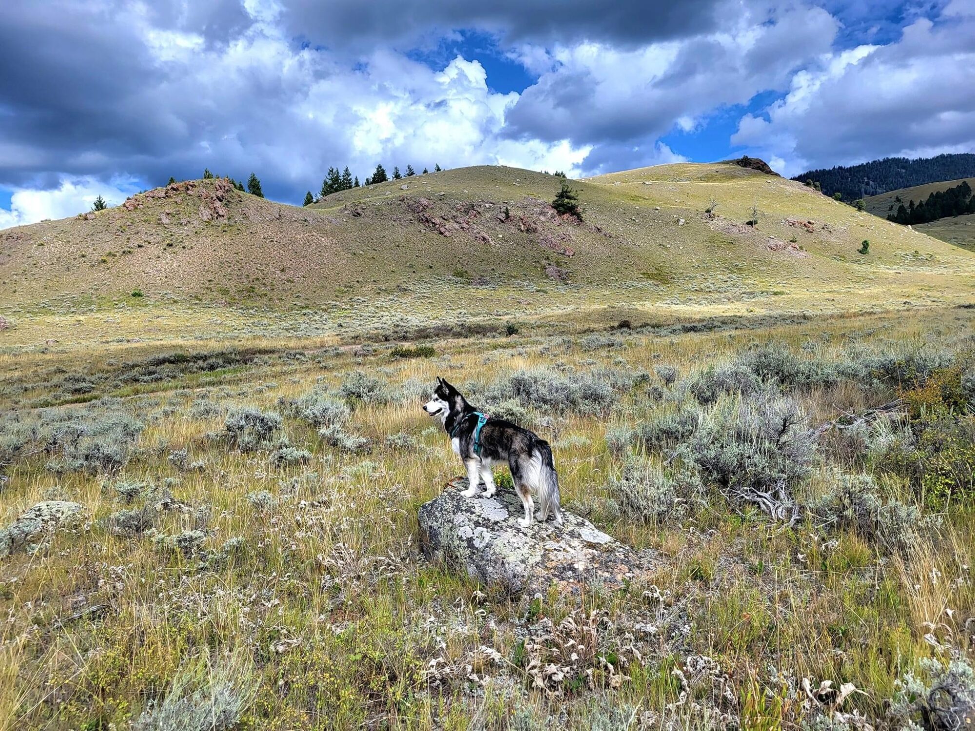
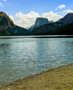
Backpack the Wind River Range
The Wind River Range in western Wyoming is a vast and rugged expanse. This alpine wilderness rivals the grandeur of the Tetons while offering far more solitude. The range stretches over 100 miles and encompasses more than 2,800 square miles. Home to Gannett Peak, Wyoming’s highest summit at 13,804 feet, evidently this wilderness houses 19 of the state’s 20 tallest peaks. Its dramatic granite spires, glacial valleys, and over 1,300 alpine lakes make it a paradise for hikers, climbers, and backpackers seeking raw, untouched beauty.
- The Winds host a significant portion of the Continental Divide Trail
- Iconic destinations like Titcomb Basin, Cirque of the Towers, and Wind River Glacier draw adventurers from around the world.
- Much of the range lies within the Bridger-Teton and Shoshone National Forests, with parts overlapping the Wind River Indian Reservation.
- The area’s isolation is part of its magic—cell service is scarce, and trails are often uncrowded, offering a true wilderness experience.
Trekking deep into the backcountry, fly-fish in crystalline lakes, or simply soak in the silence beneath towering peaks. The Wind River Range is Wyoming at its wildest and most sublime.
Where to go? Check out these hiking links, recommendations, photos and pages to start.
Protip: Make your Wind River Adventure even more compelling by canoeing Green River Lakes. Nestled beneath the towering granite spires of Squaretop Mountain, Green River Lakes is the northern gateway to Wyoming’s Wind River Range, offering a breathtaking blend of alpine serenity and wild, untamed beauty.
Learn history at the Military Vehicles Museum
The National Museum of Military Vehicles in Dubois, Wyoming, is a world-class tribute to American military history. Tucked away in the scenic wilderness, it is just 90 minutes from Yellowstone. Founded by Dan Starks and opened in 2020, this 160,000-square-foot museum houses over 500 restored military vehicles, an extensive firearms collection, and rare artifacts spanning from the Spanish-American War to modern conflicts.
Visitors can explore overall four immersive galleries:
- The Weapons Vault featuring the rifle used to fire the first shot at the Battle of Bunker Hill
- The Poolaw Building named after First Lieutenant Pascal C. Poolaw Sr. who is the most decorated Native American soldier in U.S. history.
- Exhibits include original D-Day invasion plans, battlefield soundscapes, and hands-on displays
- The museum also hosts educational programs, guided tours, and a café for guests.
Furthermore, whether you’re a veteran, a history enthusiast, or simply curious, this museum offers a powerful and moving experience that honors the service and sacrifice behind the machinery of war. Bring history to life and plan your visit here.
Skate Fremont Lake
Fremont Lake is a glacial gem tucked just northeast of Pinedale, Wyoming. It’s one of those places that feels like it belongs in a dreamscape. Besides, it’s the second-largest natural lake in the state, stretching over 12 miles long. Plunging to depths of over 600 feet, it’s one of the deepest lakes in the U.S.. The water is famously clear and cold, carved by ancient glaciers and framed by the granite peaks of the Wind River Range.
⛸️ The Experience
When conditions are just right:
- frozen cold temps
- no snow
- glassy freeze
Fremont Lake transforms into a vast, natural rink. Skaters glide over miles of clear ice, sometimes tracing bubbles frozen mid-rise or peering down into the deep blue abyss. Locals call it “wild ice,” and it’s not just a sport—it’s a ritual of freedom, solitude, and awe.
One friend described it as “flying,” where the ice was so smooth it took almost no effort to glide from shore to shore. Another recalled skating 22 miles in a single day, surrounded by moraine and mountain silence, calling it “incredibly healing”.
🌌 Night Skating & Sounds of the Ice
Some venture out under moonlight, chasing the thrill of “black ice” skating. The lake emits eerie, beautiful sounds—laser-like cracks and deep “whumpfs”—as the ice shifts and settles. It’s surreal, like skating on a living, breathing surface.
🎿 Safety & Rituals
Wild ice skaters are a dedicated bunch. They monitor weather, share updates in local groups, and test ice thickness with hatchets or drills before venturing out. It’s part science, part intuition, and all reverence.
Skating on Fremont Lake’s wild ice is like stepping into a lucid dream. Where the Wind River Mountains stand sentinel and the ice beneath your blades sings in crystalline tones. If you ever find yourself near Pinedale in winter, and the lake’s frozen just right, don’t miss the chance.
Protip: Try Willow Lake for a quieter, more intimate wild ice experience. Nestled in the foothills of Wind River Range, this lake is smaller and more sheltered which means smoother ice and fewer wind scoured patches in the right conditions.